Mapping Basics with ArcGIS Maps SDK for JavaScript, Google Maps API, and Leaflet
Learning Objectives:
At the end of the lesson, learners should be able to:
- Identify the location and geography of Kyrgyzstan
- Understand the history and culture of Kyrgyzstan
- Use ArcGIS Maps SDK for JavaScript, Google Map API, and Leaflet:
- Understand how to add and customize a map using ArcGIS JavaScript API, Google Maps API, and Leaflet
- Understand how to add markers and popups to a map
- Understand how to add and change the base map of a map

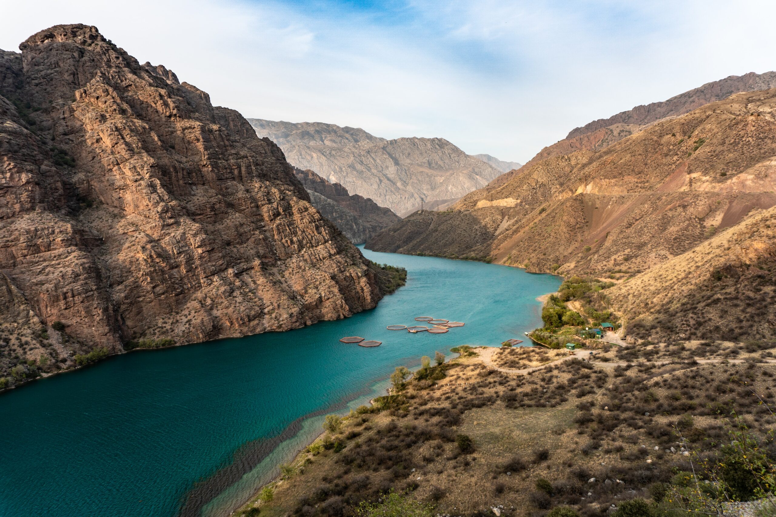
Image used for illustrative purpose only. Naryn River, Kyrgyzstan. Photo by Azamat E on Unsplash
Kyrgyzstan
Location and Geography: Kyrgyzstan is a landlocked country located in Central Asia. It shares borders with Kazakhstan to the north, China to the east, Tajikistan to the south, and Uzbekistan to the west. The total land area of Kyrgyzstan is around 198,500 square kilometers, and it is mostly mountainous. The Tien Shan mountain range covers about 80% of the country and includes peaks that rise above 7,000 meters. The country is also home to several large lakes, including Lake Issyk-Kul, which is the second-largest mountain lake in the world.
History and Culture: Kyrgyzstan has a rich history that dates back to the ancient Silk Road. The country was once a part of the Mongol Empire and later became a center of Islamic culture in Central Asia. In the 19th century, Kyrgyzstan became a part of the Russian Empire and was later a Soviet republic. In 1991, Kyrgyzstan gained independence after the collapse of the Soviet Union. Kyrgyz culture is a unique blend of nomadic traditions and Islamic influence. The country’s traditional music, Manas epic, and yurt dwelling are recognized as UNESCO Intangible Cultural Heritage. The Kyrgyz people also celebrate many festivals throughout the year, such as the Nooruz spring festival and the Kurmanjan Datka Day. Kyrgyz cuisine is based on meat and dairy products, and it includes dishes such as beshbarmak (boiled meat and noodles), plov (rice pilaf), and kymyz (fermented mare’s milk). Tea is a staple beverage, and it is often served with sweets and nuts.
Demographics and Economy: According to the CIA World Factbook, the population of Kyrgyzstan is around 6.5 million, with the majority being ethnic Kyrgyz. Other significant ethnic groups include Uzbeks and Russians. The official language is Kyrgyz, but Russian is also widely spoken. The economy of Kyrgyzstan is largely dependent on agriculture, mining, and services. The country is known for its production of gold, uranium, and other minerals. Remittances from Kyrgyz migrant workers in Russia also play a significant role in the economy. In conclusion, Kyrgyzstan is a unique country with a rich history and culture. Its mountainous geography, Islamic heritage, and nomadic traditions make it a fascinating place to explore. Understanding the country’s demographics and economy is important for analyzing its development and growth potential.

ArcGIS Maps SDK for JavaScript

Google Maps API

Leaflet
Comparison between JavaScript Mapping API
ArcGIS Maps SDK for JavaScript
Google Maps API
Leaflet
Scope
- Provides access to a wide range of basemaps: topographic maps, street maps and etc.
- Offers high-quality map rendering and labeling
- Provides advanced cartographic tools for customizing basemaps
Limitations
- Provides advanced cartographic tools for customizing basemaps
- Can be difficult to use for users with limited GIS experience
Scope
- Can be difficult to use for users with limited GIS experience
- Offers real-time traffic updates and directions
- Integrates with other Google services, such as Google Places and Google Earth
Limitations
- Limited customization options for basemaps
- Requires a Google Maps API key, which can be restricted or revoked by Google
Scope
- Lightweight and easy to use
- Provides access to a wide range of basemaps, including satellite imagery, topographic maps, and street maps
- Open-source and free to use
Limitations
- Does not offer advanced cartographic tools for customizing basemaps
- Requires additional plugins for some features
Overall, the choice of JavaScript mapping API for creating basemaps will depend on your specific needs and use case. If you require advanced geospatial analysis and visualization tools, ArcGIS JavaScript API or Google Maps API may be the best options. If you prioritize flexibility and customization, Leaflet may be the best choice.
Conclusion
In conclusion, Kyrgyzstan is a country of stunning natural beauty, with a rich culture and history. From the bustling cities of Bishkek and Osh to the remote mountain villages and natural wonders, there is something for everyone in this beautiful country. Whether you are interested in history, culture, or outdoor adventure, Kyrgyzstan has it all. Throughout this lesson, we have covered the basic concepts of viewing a map, creating markers, adding popups, and changing the base map using ArcGIS JavaScript API, Google Maps API, and Leaflet.
Further Learning:
To further your understanding and skills in using ArcGIS JavaScript API, Google Maps API, and Leaflet, here are some resources you can use. By utilizing these resources, you can continue to enhance your skills and knowledge in web mapping using these powerful tools.
Documentation:
Community resources:
ArcGIS Maps SDK for JavaScript:
Google Maps API:
Leaflet
Tutorials and courses: ArcGIS Maps SDK for JavaScript:
Tutorials and courses: Google Maps API:
Tutorials and courses: Leaflet:
- How to draw maps by using Leaflet.js
- Introduction to Digital Mapping with Leaflet
- Leaflet – Adding Interactivity to Your Maps
- Leaflet: Creating Custom Plugins for Leaflet
- Leaflet Quick Start Guide
- Mapping API’s: Leaflet – Adding Google Basemap Layers
- Mapping API’s: Leaflet – Circles and Circle Markers
- Mapping API’s: Leaflet – Creating Polylines and Polygons
References:
- Batsaikhan, U., & Dabrowski, M. P. (2017). Central Asia — twenty-five years after the breakup of the USSR. Russian Journal of Economics, 3(3), 296-320. doi: 10.1016/j.ruje.2017.09.005 Available online: https://www.researchgate.net/publication/320659496_Central_Asia_-_twenty-five_years_after_the_breakup_of_the_USSR
- CIA World Factbook: Kyrgyzstan. [online] 2023 [cit. 2023-03-30]. Available online: https://www.cia.gov/the-world-factbook/countries/kyrgyzstan/
- Common Country Analysis for the Kyrgyz Republic [online]. Inited Nations, Kyrgyz Republic, 2020 [cit. 10.02.2023]. Available online: https://minio.dev.devqube.io/uninfo-production-main/2f06c575-9d1f-4a9d-8e2c-3182db00c1c8_CCA_REPORT_-_FINAL_DECEMBER_2021.pdf
- Huang, P.-Y., Jan, J.-F. (2011). Comparison of Google Maps API and OpenLayers for WebGIS Development. Department of Land Economics, National Chengchi University. Available online: https://a-a-r-s.org/proceeding/ACRS2011/Session/Paper/P_444_9-8-19.pdf
- National Geographic: Kyrgyzstan [online]. 1996-2023 [cit. 2023-03-15] https://www.nationalgeographic.com/travel/destination/kyrgyzstan
- Roth, R. E., Donohue, R. G., Sack, C. M., Wallace, T. R., Buckingham, T. M. A. (2014). A Process for Keeping Pace with Evolving Web Mapping Technologies. Cartographic Perspectives, 78, doi: 10.14714/CP78.1273. Available online: https://pdfs.semanticscholar.org/596f/e484b4131a780f55c33fca232723bac7fd50.pdf?_ga=2.248952839.1898310656.1674741411-1331937652.1672672925
- Socharoentum, M., Karimi, H. A. (2014). A Comparative Analysis of Routes Generated by Web Mapping APIs. Cartography and Geographic Information Science, 42(1). doi: 10.1080/15230406.2014.976656. Available online: https://www.researchgate.net/publication/268209003_A_Comparative_Analysis_of_Routes_Generated_by_Web_Mapping_APIs

